Navigating the Deep: How Marine GPS Apps Reshape Coastal Living

Common Myths About Marine GPS Apps
The most enduring myth is that marine GPS apps are little more than glorified mapping tools. In reality, they integrate real-time data feeds, tide calculations, and even weather overlays—features that go far beyond static charts. Yet the idea persists that a paper chart or a basic handheld device is somehow "more reliable." This assumption ignores how quickly conditions change at sea. A tide chart printed last week might be obsolete by the time you cast off; a digital app updates hourly. Another persistent belief is that these tools are only for professionals. While commercial fleets and naval vessels have long relied on high-end marine navigation systems, the cost of entry has plummeted. Apps designed for recreational users now offer depth sounders, fish-finding algorithms, and collision-avoidance alerts—capabilities once reserved for multimillion-dollar vessels. The barrier isn’t skill or budget; it’s often a lack of awareness about what’s available.Myth 1: "All marine GPS apps are the same"
The market for marine GPS apps has exploded, but not all solutions deliver equal value. Consumer-grade apps may suffice for calm inland waters, but offshore or in heavy traffic, their limitations become glaring. For example, some apps lack the ability to display Electronic Navigational Charts (ENCs), which are mandatory for international voyages. Others struggle with signal dropout in remote areas, where satellite coverage is patchy. The reality is that the best apps for your needs depend on your environment—whether you’re navigating the Intracoastal Waterway or the open Pacific. Even within a single category, performance varies wildly. A fishing-specific app might prioritize sonar integration and waypoint management, while a sailing app emphasizes route optimization and marina databases. The mistake isn’t assuming all apps are interchangeable; it’s assuming any one app will meet every need. The solution? Start with your primary use case, then layer in additional features as required.Myth 2: "A smartphone is just as good as a dedicated marine GPS"
This is the myth that refuses to die, despite repeated demonstrations of its flaws. Smartphones are vulnerable to water damage, screen glare in bright sunlight, and battery drain during long trips. Dedicated marine GPS units, by contrast, are built for harsh conditions: they’re waterproof, often feature external antennas for stronger signals, and include backup power options. That said, modern marine GPS apps running on ruggedized tablets or dedicated navigation devices (like those from Garmin or Simrad) can bridge the gap—provided you invest in the right hardware. The trade-off isn’t binary. A smartphone with a high-quality app can work for short coastal trips, but for extended voyages, the risks of relying solely on one outweigh the convenience. The key is redundancy: pair your app with a secondary navigation method, whether it’s a paper chart, a handheld GPS, or a VHF radio check-in protocol.Myth 3: "More features mean better performance"
Feature bloat is a common pitfall in marine GPS apps. An app packed with fish-finding layers, tide calculators, and social sharing tools might look impressive, but if the core navigation functions lag or the interface is cluttered, it becomes a liability. The best apps prioritize real-time accuracy over flashy extras. For instance, an app that updates depth readings every 30 seconds is more useful than one that crams in 50 optional overlays but stutters when you need it most. Performance also hinges on data sources. Apps that rely on crowdsourced data (like some fishing apps) can be hit or miss—useful in well-trafficked areas, but unreliable in remote waters. Those backed by NOAA or professional hydrographic services provide far more consistent results. The lesson? Focus on what you’ll actually use, not what’s visually impressive.
What Holds Up to Scrutiny
At their core, marine GPS apps excel in three areas: precision, adaptability, and integration. Precision comes from their ability to cross-reference multiple data streams—GPS satellites, AIS (Automatic Identification System) signals from other vessels, and real-time weather feeds. Adaptability means these tools can switch between chart types (raster vs. vector), adjust for local magnetic variations, and even simulate "what-if" scenarios for fuel consumption or tide changes. Integration is where they truly shine: syncing with depth sounders, autopilot systems, or even onboard cameras to provide a 360-degree view of your surroundings. The evidence supports their reliability when used correctly. Studies by the U.S. Coast Guard and maritime safety organizations have shown that vessels equipped with modern marine GPS apps experience fewer grounding incidents and near-collisions. The catch? These benefits vanish if the app is misconfigured or the user ignores its limitations. A 2022 report from the National Oceanic and Atmospheric Administration (NOAA) found that 60% of navigation-related accidents involved human error—often because crews relied too heavily on automated tools without verifying their inputs."The most advanced GPS app won’t save you if you don’t know how to read a chart or understand basic seamanship. Technology amplifies skill; it doesn’t replace it." —Captain Elias Carter, Marine Safety Consultant (NOAA)
| Common Belief | What the Evidence Says |
|---|---|
| "Marine GPS apps are only for big boats." | Apps like Navionics and FishBrain are used by everything from kayaks to superyachts, with scaled-down features for smaller vessels. |
| "They’re too expensive for casual users." | Basic subscription plans start around $20–$50/year, with one-time purchases for chart data often under $100. |
| "All apps work the same way." | Sailing apps prioritize route planning; fishing apps focus on sonar and waypoints; commercial apps integrate with fuel and cargo logs. |
| "They’re not accurate enough for serious navigation." | When paired with ENCs and corrected for local variations, modern apps match or exceed the accuracy of traditional paper charts. |
| "You don’t need backup power for a smartphone app." | Battery life varies widely; even high-end devices can drain in 4–6 hours of active use, leaving you without navigation. |
Why the Confusion Persists
Part of the problem stems from the rapid evolution of the technology. Five years ago, marine GPS apps were clunky, expensive, and limited to niche audiences. Today, they’re polished, affordable, and accessible—but that speed of change has left some users behind. Older sailors, in particular, may distrust anything that isn’t a physical chart or a bulky plotter, even when the digital alternative is demonstrably superior. Marketing also plays a role. Some app developers overpromise capabilities (e.g., "never get lost again") while downplaying the need for user expertise. Others bury critical limitations in fine print, leaving consumers to discover them the hard way—like when an app fails to update during a storm because it relies on cellular data. The result? A cycle of hype followed by disappointment, which fuels skepticism about the entire category. Finally, there’s the issue of fragmentation. With dozens of apps catering to specific needs—fishing, sailing, cruising, commercial—it’s easy to pick the wrong tool for the job. A recreational angler might choose an app based on its fish-finding features, only to realize it lacks the charting tools needed for offshore trips. The solution isn’t to abandon marine GPS apps altogether, but to approach them with the same rigor you’d apply to any critical equipment: research, test in controlled conditions, and always have a backup.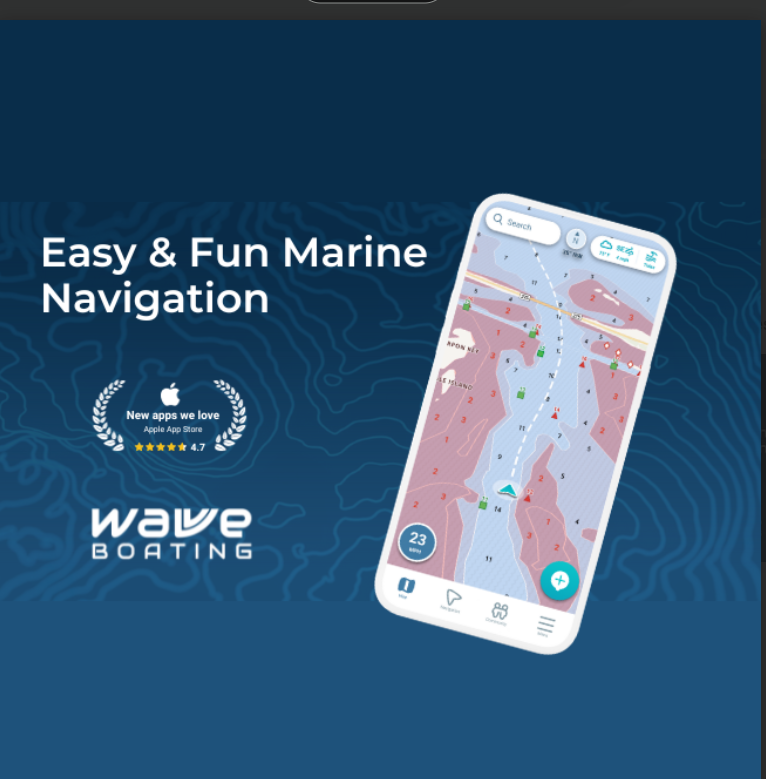
Conclusion
The most important takeaway is this: marine GPS apps are not a substitute for seamanship, but they are an indispensable tool for modern navigation. Their strength lies in their ability to process and present data faster than any human could, but their weakness is the assumption that they can do all the thinking for you. The best users treat these apps as what they are—augmented intelligence, not artificial intelligence. For those just getting started, the advice is simple: begin with a reputable app that matches your primary use case, invest in a rugged device to run it on, and take the time to learn its quirks. For experienced mariners, the shift to digital navigation should be gradual, with a clear plan for how new tools integrate with existing practices. In both cases, the goal isn’t to replace old methods but to layer them with new ones, creating a system that’s more resilient than either could be alone.Comprehensive FAQs
Q: Are marine GPS apps legal for international voyages?
A: Yes, but with conditions. Many countries require Electronic Navigational Charts (ENCs) for commercial or passenger vessels, and these must be certified by organizations like IHO (International Hydrographic Organization). Recreational users can typically rely on apps with up-to-date raster charts, but always verify local regulations—some coastal nations mandate paper backups even for digital navigation.
Q: Can I use a marine GPS app on my phone without an internet connection?
A: It depends on the app. Many modern marine GPS apps allow you to download chart data and waypoints for offline use, but features like real-time AIS traffic or weather updates require a connection. For remote areas, pre-loading data is essential. Apps like Navionics and Garmin’s BlueChart offer robust offline capabilities, while others (like FishBrain) may rely more on live feeds.
Q: How do marine GPS apps handle signal dropout at sea?
A: Most high-quality apps include fallback mechanisms, such as switching to older GPS satellites if newer ones fail or using DGPS (Differential GPS) corrections when available. Some also integrate with GLONASS or Galileo systems for additional redundancy. However, in extreme conditions (e.g., dense canyons or solar storms), no app can guarantee 100% uptime—which is why carrying a secondary navigation method remains critical.
Q: Do I need a separate depth sounder if I’m using a marine GPS app?
A: Not necessarily. Many marine GPS apps now include built-in sonar integration, allowing you to display depth readings directly on your charts. That said, dedicated sounders often provide higher-resolution data and better target detection for fishing. If you’re serious about angling, a separate sounder (like those from Lowrance or Humminbird) may still be worth the investment, even if your app supports basic depth tracking.
Q: Are there free marine GPS apps that are actually reliable?
A: A few, but with caveats. Apps like OpenCPN (open-source) or Navionics Free offer basic charting and navigation, but they lack advanced features like tide calculators, fish-finding, or real-time AIS. For serious use, free apps are best as supplementary tools—perhaps for route planning or checking depths in familiar waters. For offshore or commercial applications, a paid subscription is almost always the safer choice.
Q: How often should I update my marine GPS app’s chart data?
A: At a minimum, update your charts before every season and after any major voyage. Some apps (like those using NOAA data) push automatic updates, but it’s wise to manually verify that new hazards, buoys, or channel changes are reflected. For commercial vessels, ENC updates may be required monthly or quarterly, depending on the region. Always cross-reference with the latest Notice to Mariners for your area.
Q: Can marine GPS apps detect other vessels before they’re visible to the naked eye?
A: Yes, but with limitations. Apps that integrate with AIS (Automatic Identification System) can display nearby vessels hours before they’re visible, especially at night or in fog. However, not all boats transmit AIS signals (small recreational craft often don’t), and some apps may lag in updating traffic data. For high-traffic areas, pairing your app with a radar overlay (if your device supports it) adds an extra layer of safety.
Q: What’s the best way to test a marine GPS app before a long trip?
A: Start by loading your planned route into the app and simulating the trip onshore, checking for any missing chart data or waypoint errors. Then, take a short test run in familiar waters to verify that depth readings, speed tracking, and AIS alerts work as expected. Finally, test your backup power sources—whether it’s a portable battery, solar charger, or secondary device—and confirm you can switch between them seamlessly.
Related Articles
- Rockstar Games Values: Beyond the Brand’s Chaotic Myths
- The Last Chapter: When Did Erno Rubik Die and What It Means for Puzzle Culture?
- Is Pattie Boyd Still Alive? The Truth Behind the Legend’s Last Years
- Natasha Trader Joe’s List Simon Net Worth: The Hidden Wealth of a Retail Icon
- The Brett Gardner House: A Deep Look at the Star’s Private Retreat